RIFO – Urban Regeneration and Land Restoration is a project of the University of Bergamo in collaboration with Fondazione Pesenti.
THE PROJECT
RIFO – Urban Regeneration and Land Restoration is a project developed by the University of Bergamo in collaboration with Fondazione Pesenti, with a dual objective:
- The first, of an operational nature, aims to replace obsolete buildings with new constructions that can meet modern housing needs;
- The second, of a cultural nature, seeks to initiate a shift in the social perception of construction—not as a wasteful use of land and a destructive force against the landscape, but as a key factor in its regeneration.
The project’s analytical approach—which, it must be strongly emphasized, is a cultural initiative before being a technical one—relies on three essential programmatic assumptions:
- Shifting the concept of the “city” from a territorial structure to a space that expresses ecologically conscious living;
- Regenerating obsolete areas by including recreational spaces and involving residents in the design process;
- Recognizing that contemporary living needs are influenced by ecological and environmental factors, especially in regard to resource awareness and connection with nature.
RESEARCH AND ITS PHASES
The RIFO research project involves analyzing obsolete and abandoned areas and buildings, and assessing their potential for urban regeneration and land restoration.
PHASE I
Designed at a national scale, the project has so far completed its first phase focused on the Lombardy region, creating a database that maps the location, quantity, and quality of abandoned areas and obsolete buildings.
This first phase also allowed the formulation of a methodology (RIFO) based on:
- Identifying obsolete and abandoned buildings within the same neighborhood to allow short-distance relocation of residents;
- Constructing eco-sustainable buildings in place of demolished obsolete/abandoned structures, maintaining the same volume but reducing built surface area to make room for green spaces;
- Implementing governance and participatory actions to reclaim the “spatial capital” in territorial design and reconstruction.
PHASE II
The second phase aims to expand the territorial analysis in Lombardy and evaluate the practical applicability of the RIFO methodology.
THE MAPS
rifo/map is an interactive mapping tool that quantifies and displays types of abandoned and obsolete properties for each municipality in Lombardy, allowing comparative analysis. It is an open, queryable system that identifies the number of obsolete and abandoned buildings, shows their intended use, compares different types, and provides a comparative view of urbanized land.
rifo/3d is an interactive, 3D mapping tool that explores the opportunities for demolition and reconstruction of individual obsolete and abandoned buildings in Lombardy.
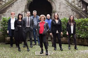
The RIFO project team, led by Prof. Emanuela Casti.
THE WORKING GROUP
The research was carried out within the Centro Studi sul Territorio – CST-DiathesisLab, a cartographic research and experimental lab at the University of Bergamo, coordinated by Emanuela Casti.
The team, composed of 8 researchers (mostly geographers, as well as urban planners and IT specialists) and 3 students, conducted the RIFO study from mid-2013 for about two years, focusing on obsolete and abandoned properties across Lombardy.
The large building stock, once regenerated, could meet the demand for public housing while also enabling land restoration from prior overdevelopment.
www.rifoit.org